St Mary's Island Masterplan
Chatham, UK

project overview
A significant masterplan on one of Europe’s largest regeneration sites
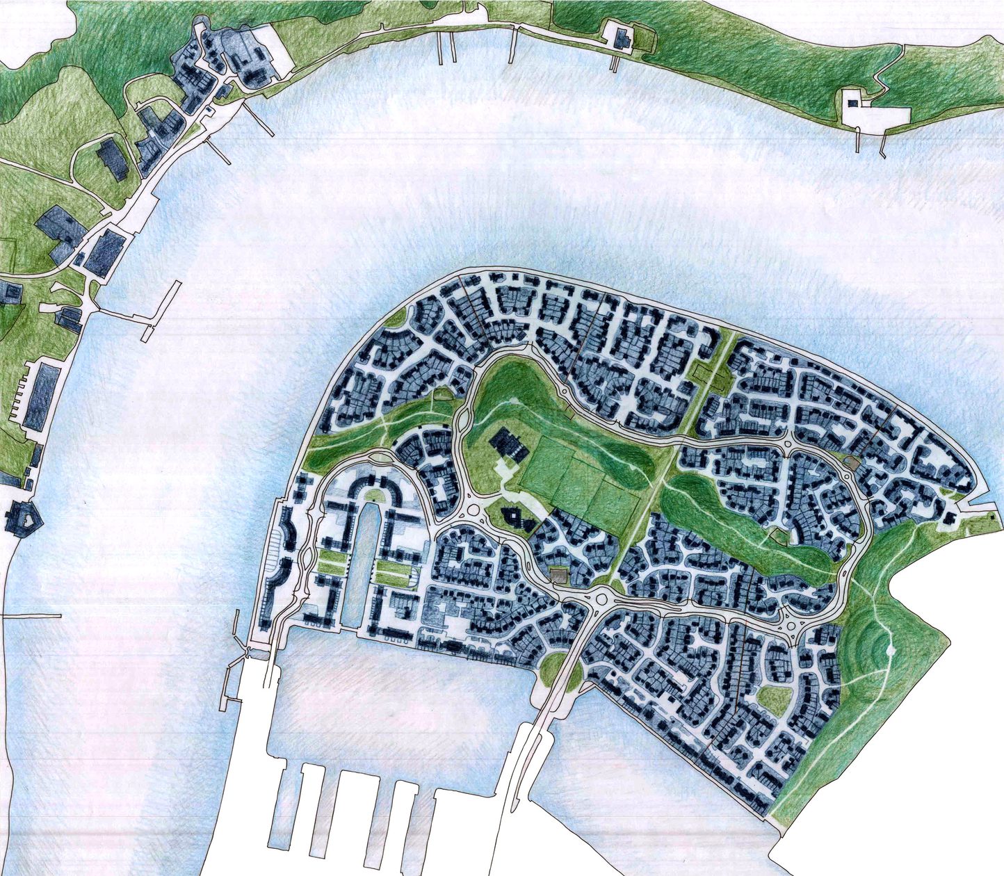
St Mary’s Island is Britain’s only strategically planned island community, creating a modern suburb with a strong maritime character. Across 150 acres, the scheme seamlessly integrates 1,700 homes with shops, a school and other community facilities, public open spaces and a marina.
Over 20 years in the making, our masterplan strategy is an exemplar of sustainable brownfield development. Our thoughtful masterplan creates a strong identity appropriate to the site’s history as a naval dockyard, for a thriving community of residents, businesses and visitor attractions.
site history
Exemplar reuse of a brownfield site for much needed homes
Dating back to 1547, the original dockyard has been the site of over 400 years of shipbuilding for the Royal Navy, including the building of Nelson’s flagship, HMS Victory. Resulting in a heavily contaminated plot which underwent extensive remedial works leaving a flat, virtually featureless, site.
With a strong demand for affordable homes in the region, the site underwent extensive remediation and structural landscaping to make it suitable for development. Our involvement began in 1999, to enhance the site’s value and address the need for more homes on the island, we were commissioned to review the original masterplan.
Our development of the original masterplan enhanced the site’s value, addressing the need for more homes on the island through the production of a design code. We established principles for every part of the masterplan to inspire quality of any and all future development.
We then went onto the detailed design and delivery of sector 5 of the masterplan, the award winning Fishing Village and sectors 7 / 8 known as North Shore. Following this, we were selected to complete the final phases of development (sectors 10, 11, 13 and 15) at the western end of St Mary’s Island after winning a two stage architectural competition.
Masterplan development
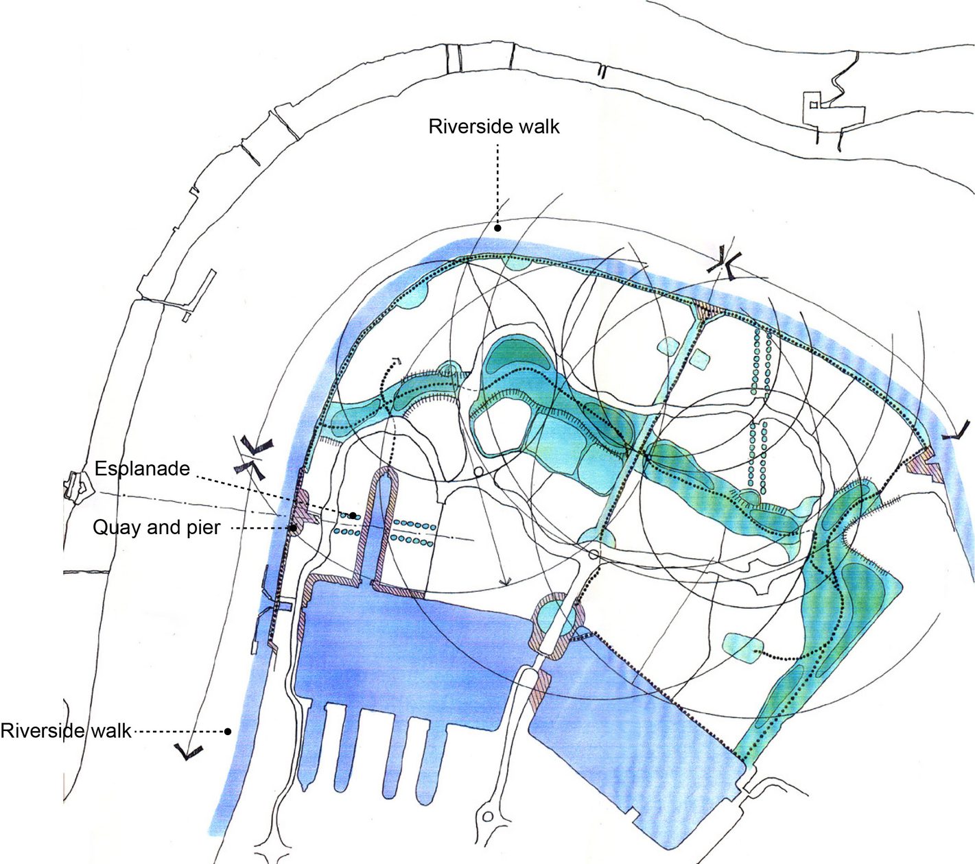
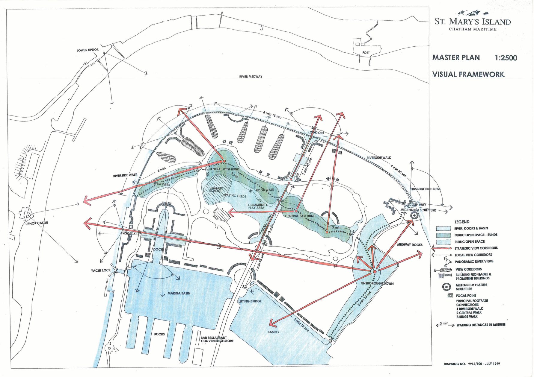
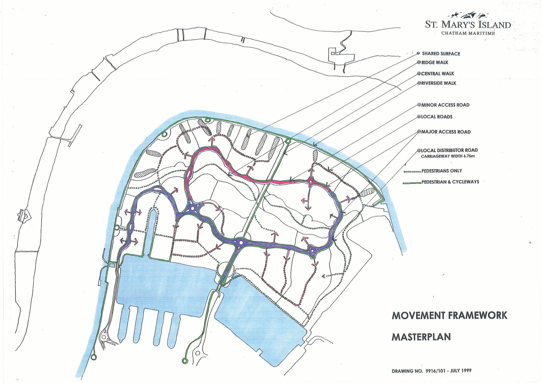
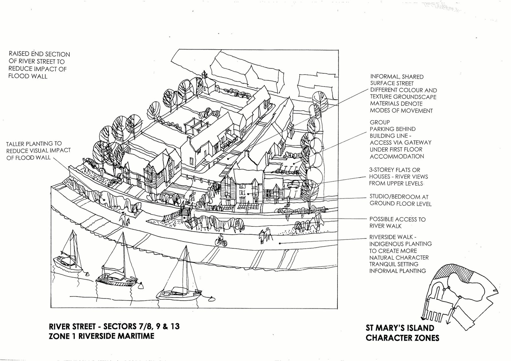
A navigable masterplan linking back to the wider community
Design code
Building legacy for all future development
Our masterplan design code focuses on five key principles of placemaking; cohesion, hierarchy, place, ownership and memory - established to assist designers and developers with future phases and create one unified identity. It takes into consideration the Medway Housing Design Standards, Kent Design Guide, local planning guidance as well as the requirements of St Mary’s Island Residents Associate and the Chatham Maritime Trust. Each sector has special civic character, interest and unity, such as parks, squares and promenades. Designed to integrate with the wider masterplan for the island, transport links and infrastructure.
key information
Project summary
Location
Chatham, Kent, ME4
Client
Countryside Maritime
Completion
2023
Value
£60m
Includes
1,700 homes
Schools
Retail
Community facilities
Public realm
Contact
Interested in
learning more?
Learn more about 'St Mary's Island Masterplan' and other projects by reaching out to one of our team
Get in touchRelated Projects

Victoria Square
A major mixed-use, town centre regeneration project bringing together a new health and wellbeing centre, 35 homes and a 70-bed hotel with improved public realm and a modern bus interchange.

Birkenhead Commercial District Masterplan
This masterplan will be a catalyst for transformational change in the region and an exciting new chapter in Birkenhead’s history.

The Exchange
Designed to enhance the lives of the residents, whilst also addressing the need for more outdoor family space in the city